Troodos-Nature Trails-2
Lagoudera - Agros (Linear) Nature Trail
This path runs through vineyards and orchards of apple, cherry and pear trees.
| Start Point: | The rural road between Lagoudera and Chandria - Polystypos main road, 700 metres from Lagoudera village. |
| End Point: | Agros village, (along the Agros by-pass, at a point above the dam) |
| Estimated Duration: | 2 hours and 30 minutes |
| Difficulty Rate: | High degree of difficulty. Route with difficult terrain such as sudden changes in gradient (uphill and/or downhill). Unsuitable for young children. |
| Trip Length: | 6 kilometres |
Kourdali - Limeria (Linear) Nature Trail
The trail passes through rich forest vegetation offering the opportunity to visit various hideouts used by E.O.K.A fighters during the 1955-1959 anti-colonial campaign.| Start Point: | Kourdali village. Location Selladi tis Straorouthkias is accessed 2 kilometres on the loose surface road from Spilia village, thereon walking for a further 2 kilometres towards location Limeria. |
| End Point: | Limeria (Spilies tou Digeni) |
| Estimated Duration: | 1 hour and 30 minutes |
| Difficulty Rate: | Average degree of difficulty, suitable for adults in fair to good fitness levels. |
| Trip Length: | 3,6 kilometres |
Pinewood Valley Hiking Trail
Area flora of interest is signposted.
| Start Point: | Pedoulas - Prodromos - Troodos main road, near the road leading to "The Churchill Pinewood Valley" hotel. |
| Estimated Duration: | 30 minutes - 1 hour |
| Difficulty Rate: | Easy trail, with gentle gradient. Suitable for all ages and fitness levels. |
| Trip Length: | 800 metres |
Kionia - Profitis Elias (Linear) Nature Trail
| Start Point: | Kionia picnic site. Access from Panagia tou Machaira monastery road leading to Kionia peak, or from Vavatsinia village towards Panagia tou Machaira monastery. |
| End Point: | At Profitis Elias monastery, about 8 kilometres west of Lythrodontas village and 6 kilometres from Mantra tou Kampiou, access being along loose surface roads. |
| Estimated Duration: | 2 hours and 30 minutes |
| Difficulty Rate: | High degree of difficulty. Route with difficult terrain such as sudden changes in gradient (uphill and/or downhill). Unsuitable for young children. |
| Trip Length: | 7 kilometres |
Katarraktis Myllomeris (Linear) Nature Trail
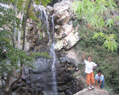
The trail leads through rich vegetation to Katarraktis Myllomeris (waterfall).
| Start Point: | Between Pano Platres church and village centre, more towards the church. There is vehicular access to the falls at the end of the route, via loose surface roads, starting from a point along the main Platres–Limassol road, about 1 kilometre from location Psilo Dendro. |
| End Point: | Katarraktis Myllomeris (waterfall). |
| Estimated Duration: | 30 minutes |
| Difficulty Rate: | High degree of difficulty. Route with difficult terrain such as sudden changes in gradient (uphill and/or downhill). Unsuitable for young children. |
| Trip Length: | 1,2 kilometres |
Kannoures - Agios Nikolaos Tis Stegis (Linear) Nature Trail
| Start Point: | On the main Karvounas–Troodos square road, 1 kilometre before Troodos Square (Plateia Troodous), 9,5 kilometres from location Karvounas. |
| End Point: | Ends at Agios Nikolaos tis Stegis church, or continues up to Kakopetria village |
| Estimated Duration: | 3 hours (4 hours up to Kakopetria village) |
| Difficulty Rate: | High degree of difficulty. Route with difficult terrain such as sudden changes in gradient (uphill and/or downhill). Unsuitable for young children. |
| Trip Length: | 9 kilometres (12 kilometres up to Kakopetria village) |
Teichia tis Madaris Trail (Circular) Nature Trail
It connects with the Madari - Doxa si o Theos and Madari-Selladi tou Karamanli trails.
| Start Point: | Near Madari fire lookout station, by the end point of Doxa si o Theos - Madari trail. The starting point can be accessed by vehicle from Chandria – Polystypos main road in the direction of Madari peak, 3 kilometres away. |
| Estimated Duration: | 1 hour and 30 minutes |
| Difficulty Rate: | Average degree of difficulty, suitable for adults in fair to good fitness levels. |
| Trip Length: | 3 kilometres |
Alona Petrou Vanezi (Circular) Nature Trail
The trail goes through hazelnut, cherry, apple and almond trees to reach a water stream.
| Start Point: | At two points on the main road of Alona village. One point is located by the Alona Co-operative building. The second point is located 300 metres further to the south, by the village church. |
| End Point: | Alona village |
| Estimated Duration: | 30 minutes |
| Difficulty Rate: | High degree of difficulty. Route with difficult terrain such as sudden changes in gradient (uphill and/or downhill). Unsuitable for young children. |
| Trip Length: | 1,5 kilometres |
Arsos (Linear) Nature Trail
| Start Point: | Arsos village, at Athkies fountain, on the main road towards Agios Nikolaos village. Traverses Arsos village. In its reverse course it may commence from Poullin fountain to the west of the village. |
| End Point: | Poullin fountain |
| Estimated Duration: | 45 minutes |
| Difficulty Rate: | Easy trail, with gentle gradient. Suitable for all ages and fitness levels. |
| Trip Length: | 2 kilometres |
Artemis (Circular) Nature Trail
The route is circular, going round Olympos mountain peak (Chionistra) at an altitude of 1.850 metres and offering spectacular views in all directions. It can link up with the Atalanti trail.
| Start Point: | 300 metres from the junction between the road to Olympos mountain peak (Chionistra) and Troodos – Prodromos main road. |
| End Point: | Olympos mountain peak (Chionistra) |
| Estimated Duration: | 2 hours and 30 minutes – 3 hours |
| Difficulty Rate: | Easy trail, with gentle gradient. Suitable for all ages and fitness levels. |
| Trip Length: | 7 kilometres |
Agia Eirini - Limeria (Linear) Nature Trail
At Selladi tis Straorouthkias this trail meets the Kourdali - Limeria (Spilies tou Digeni) trail and the two continue on a common route for 2 kilometres.
| Start Point: | Agia Eirini village. Location Selladi tis Straorouthkias is accessed 2 kilometres on the loose surface road from Spilia village, thereon walking for a further 2 kilometres towards location Limeria. |
| End Point: | Limeria (Spilies tou Digeni) |
| Estimated Duration: | 2 hours and 30 minutes |
| Difficulty Rate: | High degree of difficulty. Route with difficult terrain such as sudden changes in gradient (uphill and/or downhill). Unsuitable for young children. |
| Trip Length: | 5 kilometres |
Agros - Kato Mylos (Circular) Nature Trail
| Start Point: | Near “Rodon” hotel at Agros village. |
| End Point: | Agros village |
| Estimated Duration: | 2 hours |
| Difficulty Rate: | Average degree of difficulty, suitable for adults in fair to good fitness levels. |
| Trip Length: | 6 kilometres |
Agros - Madari (Linear) Nature Trail
This trail offers panoramic views.
| Start Point: | From Agros village. On the Agros by-pass, at a point above the dam. The course joins at the Chandria/Polystypos - Agros village, 800 metres before the road point leading to the Adelfoi peak and Madari fire lookout station. |
| End Point: | Madari |
| Estimated Duration: | 3 hours |
| Difficulty Rate: | High degree of difficulty. Route with difficult terrain such as sudden changes in gradient (uphill and/or downhill). Unsuitable for young children. |
| Trip Length: | 3 kilometres |
Ariadni (Circular) Nature Trail
| Start Point: | From ‘Tree Tops’ hotel, just after Gerakies village, towards Panagia tou Kykkou monastery. |
| End Point: | ‘Tree Tops’ hotel |
| Estimated Duration: | 2 hours and 30 minutes |
| Difficulty Rate: | High degree of difficulty. Route with difficult terrain such as sudden changes in gradient (uphill and/or downhill). Unsuitable for young children. |
| Trip Length: | 5 kilometres |
Asinou - Agios Theodoros (Linear) Nature Trail
| Start Point: | Asinou church |
| End Point: | Agios Theodoros village in Solea valley |
| Estimated Duration: | 1 hour and 30 minutes - 2 hours |
| Difficulty Rate: | Average degree of difficulty, suitable for adults in fair to good fitness levels. |
| Trip Length: | 5,6 kilometres |
Atalanti Trail (Circular) Nature Trail
The path goes round Chionistra (Olympos mountain peak) at an altitude of 1.700 - 1.750 metres. Admired on this walk is one of the largest Junipers, an 800 year - old specimen
| Start Point: | Troodos Square (Plateia Troodous) |
| End Point: | Troodos Square (Plateia Troodous) |
| Estimated Duration: | 4 - 5 hours |
| Difficulty Rate: | Average degree of difficulty, suitable for adults in fair to good fitness levels. |
| Trip Length: | 14 kilometres |
G. Taramidis (Linear) Nature Trail
This trail offers panoramic views.
| Start Point: | Loose surface road after Kionia picnic site towards Kionia peak. |
| End Point: | On asphalt road near Panagia tou Machaira monastery. |
| Estimated Duration: | 1 hour and 30 minutes |
| Difficulty Rate: | Average degree of difficulty, suitable for adults in fair to good fitness levels. |
| Trip Length: | 3,4 kilometres |


